The Field Data Entry dashboard allows for the Web Forms data entry and uploading of information collected during field activities. This dashboard has three sections configured to display as horizontal tabs:
Click the desired tab to navigate to that portion of the dashboard. Select the Filter tab to display the EQuIS Geotech side menu.
Filter Tab
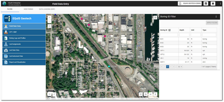
The Filter tab on the Field Data Entry dashboard contains a Map widget and a Data Grid widget (i.e., Boring ID Filter) configured to filter by location.
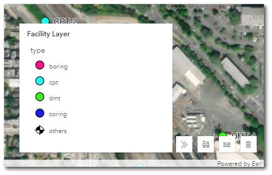
The Facility Layer on the Map widget can be configured to differentiate between the type of drilling/boring locations.

To filter the Map widget, select the desired boring(s) in the Boring ID Filter widget. Use the Shift and/or Ctrl keys to select multiple locations. Click the Apply Filter button to activate the filtering. The Boring IDs will be displayed at the top of the widget. Click the Clear button to clear filtering.
Web Forms Tab
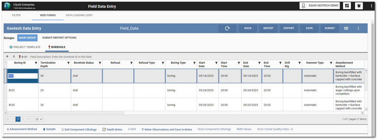
The Web Forms tab on the dashboard contains a Web Forms widget setup to use the Geotechnical Field Data Entry Collect template designed for geotechnical field data entry.
New data forms can be created either by using Collect or by selecting the Create Data Form button on the Web Forms widget header. If locations are selected in the Boring ID Filter widget on the Filter tab, new data forms will only display records for the selected location(s). Existing data forms will display all records when edited.
See the Web Forms widget help documentation for details about using the widget for data entry.
Data Loading (EDP) Tab
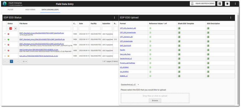
The Data Loading (EDP) tab on the dashboard contains an EDP EDD Upload widget that can be used to upload field data and an EDP EDD Status widget to monitor the status of the uploaded field data files.


